What It’s Like Living On The Spokane River
March 12, 2026
March 12, 2026
Morning light on calm water. The low hush of current around rocky banks. If you’ve wondered what daily life feels like along the Spokane River in Post Falls, you’re not alone. You want clear, local insight before you invest. In this guide, you’ll learn how the river behaves through the seasons, where you can launch a boat or paddleboard, the rules that shape boating, what anglers catch, and the key due‑diligence steps for waterfront property. Let’s dive in.
The Spokane River flows west out of Lake Coeur d’Alene and runs through Post Falls, framed by tree‑lined corridors and the historic Post Falls Dam and falls. Public viewpoints and parks bring you close to spillways and short rapids, creating a dramatic backdrop you notice in every season. The city’s planning documents describe this manmade and natural interplay that defines the local river experience. You can preview that context in the city’s comprehensive plan resources for a sense of the setting and public spaces along the corridor (City of Post Falls comprehensive plan).
Post Falls has an estimated population near 45,800 residents, with a citywide owner‑occupied median home value around 477,400 dollars and a mean commute of about 24.1 minutes. These figures help frame lifestyle and access if you split time between home and work hubs (U.S. Census QuickFacts). You sit about 20 miles east of Spokane and just a few miles from downtown Coeur d’Alene, which is helpful if you use services or commute in either direction.
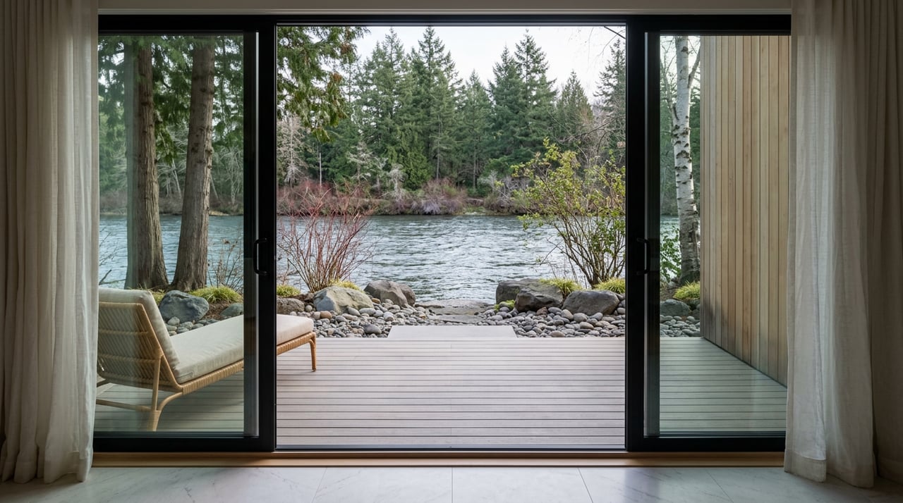
Living on the Spokane River means you experience shifting flows across the year. Spring runoff and dam releases bring higher, faster water and more audible current. Late summer and early fall usually see calmer conditions and lower water levels that matter for small‑boat depth. Hydropower operations upstream and downstream influence pool levels, which is why many owners check the USGS river gauge and Avista’s public updates before planning dock use or maintenance. For an overview of how recreation is monitored and communicated, review Avista’s Spokane River Project materials (Avista recreation monitoring) and technical resources on managed river systems (Science.gov topical overview).
Sound and activity also change with location and season. Near parks and lookouts, you’ll hear the river and see more visitors on warm weekends. On quieter residential stretches, expect a steady mix of boaters, paddlers, and anglers during peak months. Winter brings a calmer rhythm as activity drops and views open through the trees.
You have multiple ways to get on the water. Q’emiln Park is a primary riverfront hub with a guarded swimming beach, paved trails, climbing walls, and a public boat launch, making it a popular starting point for boaters and paddlers (Q’emiln Park details). For nonmotorized routes, the Spokane River Water Trail lists put‑in and take‑out locations so you can plan safe segments that match your skills and day plan (Spokane River Water Trail launches).
You’ll see a blend of activity: kayaks and SUPs in protected pockets, fishing boats working structure, and powerboats in wider, calmer reaches. Because the river includes islands, constrictions, and dam zones, traffic concentrates in marked channels and at designated launches. Avista and local agencies publish maps, advisories, and seasonal notices that help you understand safe segments and changing conditions (Avista recreation monitoring). Kootenai County’s waterways code defines no‑wake stretches and restricted areas on the Spokane River. If you’re eyeing wake sports or higher‑speed boating, verify whether your prospective frontage sits inside a posted no‑wake zone or speed‑restricted segment (Kootenai County Waterways Code).
The Post Falls reach supports warm‑water species, including notable smallmouth bass. Trout appear in colder or upstream pockets, and seasonal regulations protect certain runs. Some stretches may have spring closures, so it pays to confirm open seasons and rules before you fish. Because the river crosses state lines, check both Idaho and Washington regulations and current advisories. A regional guide provides a helpful overview of species and seasons to expect (Spokane River fishing overview).
Dams and associated hydraulics create serious hazards. Always use established launches and obey posted signs and closures. Seasonal changes in flow can affect currents near islands, under bridges, and around constrictions. If you welcome guests who are newer to the river, set clear meet‑up points and share the day’s plan before anyone heads out.
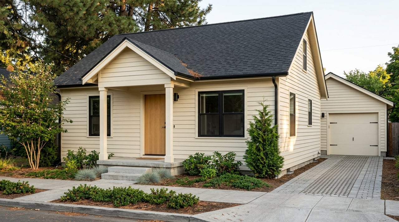
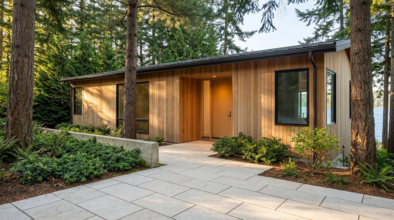
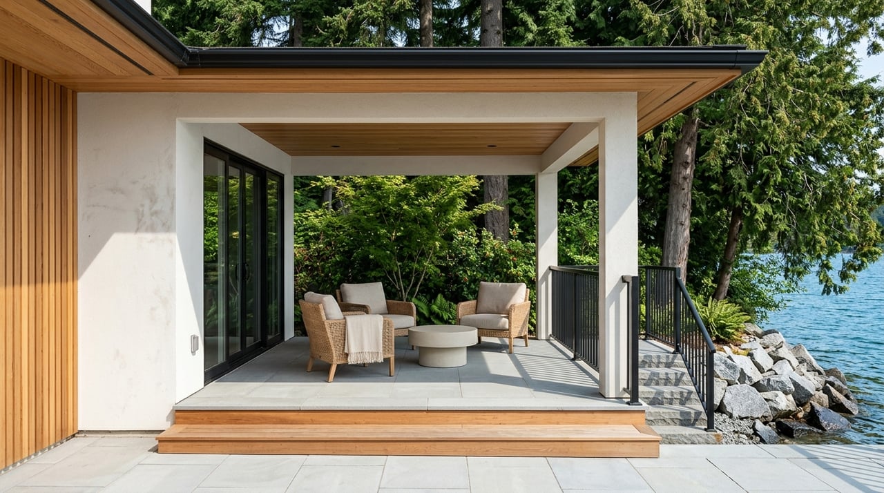
In Post Falls you’ll find single‑family riverfront homes with private docks, small condo developments with seasonal moorage, and lots with a mix of bank types from rocky edges to sandy pockets. Waterfront frontage typically trades at a premium compared with non‑water properties in the city. For broad context, the city’s owner‑occupied median home value is roughly 477,400 dollars, though riverfront pricing varies widely based on frontage, permitted dock, depth, and bank condition (U.S. Census QuickFacts).
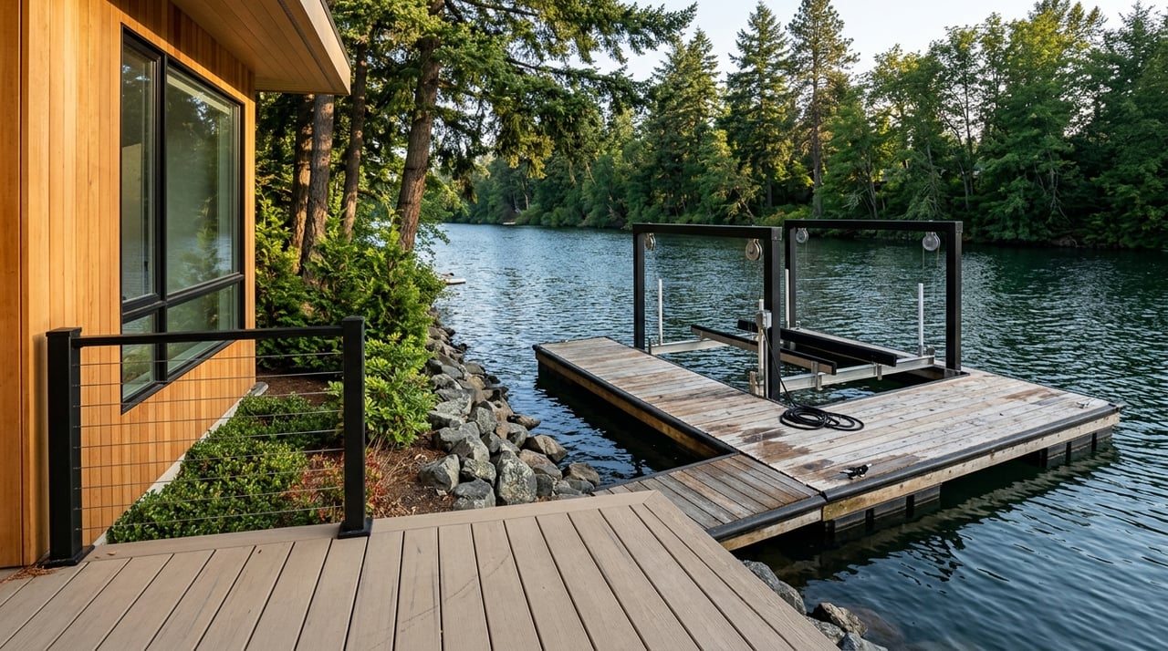
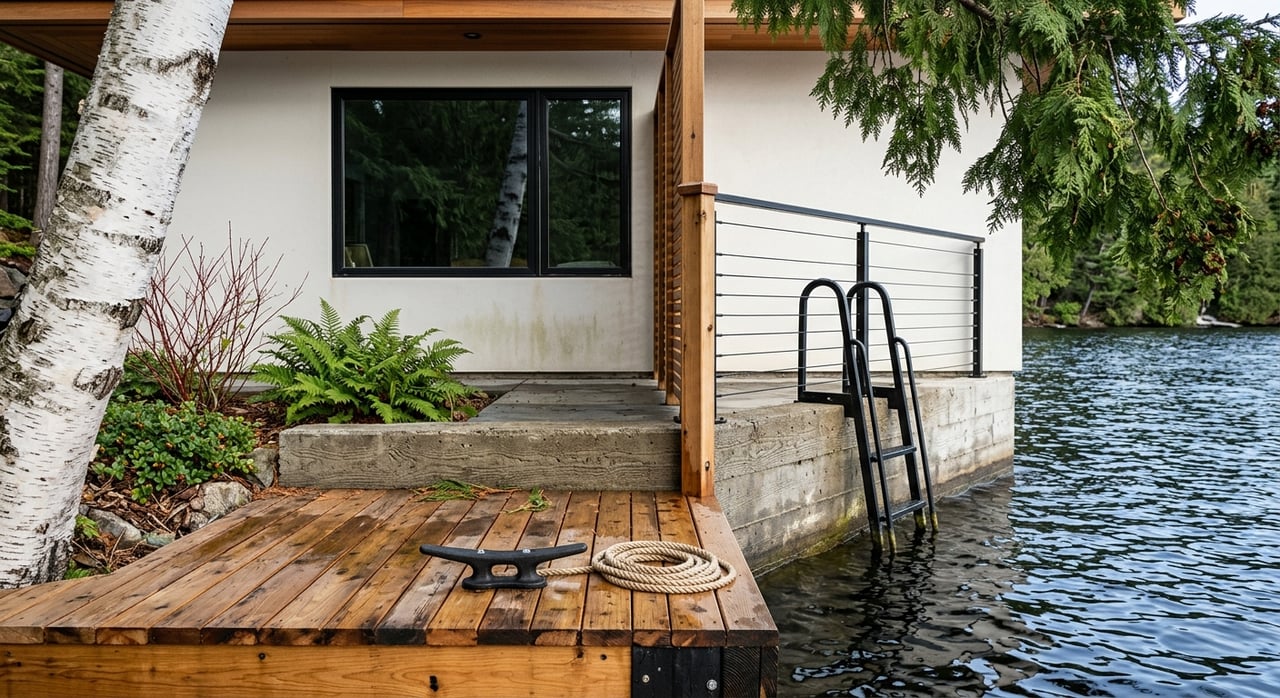
Idaho’s Lake Protection Act requires encroachment permits through the Idaho Department of Lands for docks, bank stabilization, marinas, and many structures that extend into navigable waters. Single‑family docks may qualify for exemptions if they meet size and design criteria, but most new or altered encroachments need IDL review and public notice. When evaluating a property, ask for copies of any IDL encroachment permits or Submerged Land Lease documents and confirm they match what you see on site (Idaho Department of Lands encroachments).
Many riverfront parcels sit near mapped floodplains. Lenders often require a flood zone determination and may require flood insurance if a structure lies in a Special Flood Hazard Area. Pull the FEMA Flood Insurance Rate Map for the address and request any available elevation certificate. The city’s planning and water‑reclamation documents identify flood‑prone corridors along the Spokane River, which is a helpful starting point for risk conversations and inspections (City of Post Falls water‑reclamation plan). If you see riprap or steeper banks, consider a geotechnical opinion on stability and long‑term maintenance.
River living usually includes higher maintenance for docks, lifts, and moorage equipment. Seasonal water level changes and winter conditions can speed wear. Budget for periodic inspections and repairs, and keep a clean file of permits, approvals, and contractor records. Doing so streamlines future insurance renewals and buyer due diligence if you decide to sell.
Many residents commute to Coeur d’Alene or Spokane. The city’s mean travel time is about 24.1 minutes, which reflects the region’s multi‑center commute pattern and drive‑first layout (U.S. Census QuickFacts). From the river corridor in Post Falls, you can reach downtown Coeur d’Alene within minutes and Spokane within a typical 20 to 40 minute window, depending on start point and traffic. Healthcare, dining, and retail services are available in both directions, giving you flexibility for daily errands or appointments.
The Spokane River offers a linear, tree‑framed boating experience with pockets of calm water and visually dynamic stretches near dams and islands. Daily launches can feel straightforward thanks to multiple public access points, and the corridor connects with trails and parks that support year‑round use. By contrast, Lake Coeur d’Alene delivers broad, open water with more marinas, resort amenities, and quick access for larger boats. If you prioritize quick lake cruising and full‑service moorage, the lake’s marina network can be a deciding factor (Lake Coeur d’Alene marinas and moorage). If you want a quieter, sheltered corridor close to everyday conveniences, the river’s character may suit you better.
Waterfront decisions hinge on details: permitted docks, seasonal depth, bank condition, and the fine print in local codes. As a North Idaho boutique team focused on luxury, lakefront, and lifestyle properties, we guide you through the specifics that protect time and value. We coordinate due diligence with the right specialists and keep the process calm and organized so you can enjoy the reasons you came for the water in the first place.
Here’s how we can streamline your search:
Ready to explore riverfront options in 83854 with a trusted local guide? Request a Private Consultation with Michaela Corcoran‑Hall to start a thoughtful, well‑paced search.
Stay up to date on the latest real estate trends.
Work with them for high-touch real estate service in North Idaho. Their local market mastery, proven results, and client-first approach deliver seamless, strategic transactions.